Death Valley Flooding & Road Damage - Complete Visitors Guide
Hi friends! This week I’m taking you on a special road trip adventure through Death Valley National Park. In late August, the remnants of Hurricane Hilary ripped across California, hitting Death Valley and the surrounding regions particularly hard. Setting the record for the wettest day, the national park received over 2 inches of rain during the storm, which is more precipitation than it typically receives in an entire year! This resulted in major flooding and extensive road damage, causing the park to close for nearly 2 months, the longest closure in Death Valley’s history.
Last week, Death Valley National Park triumphantly reopened to the public on Sunday 10/15, and I was there to document the historic experience, including the temporary lake covering Badwater Basin. Join me below as I take you along my journey through the park, providing you with a complete travel guide and all the information you need to plan for your upcoming visit during this unprecedented season in the park.

Badwater Basin lake seen from Dante’s View

Kia Sportage on Natural Bridge Road with views of Badwater Basin flooding
Traffic Delays, Road Damage & Closures
Before we begin, it’s important to note that much of Death Valley National Park is still closed to the public. The historic flooding deposited dirt and rocks up to 5 feet deep on some roads and chunks of the highway crumbled and washed away. Crews have been working around the clock throughout the park to make it safe for visitors, so please “pack your patience”, knowing that you will encounter delays of up to one hour in some spots. So give yourself plenty of extra time along your journey, and give the workers plenty of grace, understanding that they’re working in extreme conditions to restore these roads that we so often take for granted.

Lone Pine Peak & Mount Whitney seen from the Eastern Sierra Visitor Center
Getting to the Park
As I mentioned earlier, the surrounding regions sustained quite a bit of road damage as well, so be thoughtful about what route you take to Death Valley. Currently there are only two ways to enter the park. The first is California State Route 190 from the west via the 136 just before Lone Pine, and the second is from the east via Death Valley Junction...all other park entrances are closed until further notice. Prior to visiting, it’s always wise to check out the official Death Valley NPS website for the most up-to-date road and entrance conditions.
I opted to head in from the west via Lone Pine since I was already in the Eastern Sierra checking out the Fall colors 🍁. Keep in mind that if you’re coming up from the south, the stretch of the 190 from Olancha is closed due to road damage, so you’ll have to continue north to the 136 and work your way around Owens Lake. Although it adds mileage to your trip, consider it a treat because the usually dry lake is full again and quite a sight to see. Make sure to stop off at the Eastern Sierra Visitor Center at the 395/136 junction to learn more about the region and for some magnificent views of Mt Whitney, the tallest peak in the lower 48 states.
I didn’t encounter road construction delays along the 190 before entering the park, but that was likely due to it being a Sunday. If you travel in on a weekday, crews will likely stop you for one-lane escorts along this stretch.

Superbloom of desert globe mallow along SR-190

Traffic Stop entering Death Valley West Entrance
West Entrance
Just prior to the west entrance, make sure to stop off to enjoy a rare superbloom of the desert globe mallow surrounding the Joshua trees and blanketing the landscape. The first traffic stop I experienced was located right at the official entrance to the park. This is the most extensive potential delay currently in the park, causing vehicles to be stopped for up to an hour. My wait time was about 30 minutes, which provided plenty of time to take pictures with the Death Valley National Park sign and chat with the kind construction worker stationed there with the stop sign.
After waiting a half hour, the caravan was escorted approximately 30 miles through Panamint Springs, down across the Panamint Valley, and halfway up the Panamint Range prior to reaching the summit. Panamint Springs Resort is open and vehicles were allowed to depart from the long caravan at that point. The Father Crowley Overlook on the other-hand is closed off, and the road to Darwin Falls is completely washed out (I can’t imagine this dirt road being restored for quite some time). The turnoff at Panamint Valley Road is also clearly closed off along the escort, reinforcing that you won’t be able to access the park from the south via Trona and the Searles Valley. All along the drive, the caravan encountered countless areas where the road had been covered with debris or had crumbled away...so drive alertly while enjoying the views.
Click here for my full blog post on Darwin Falls.

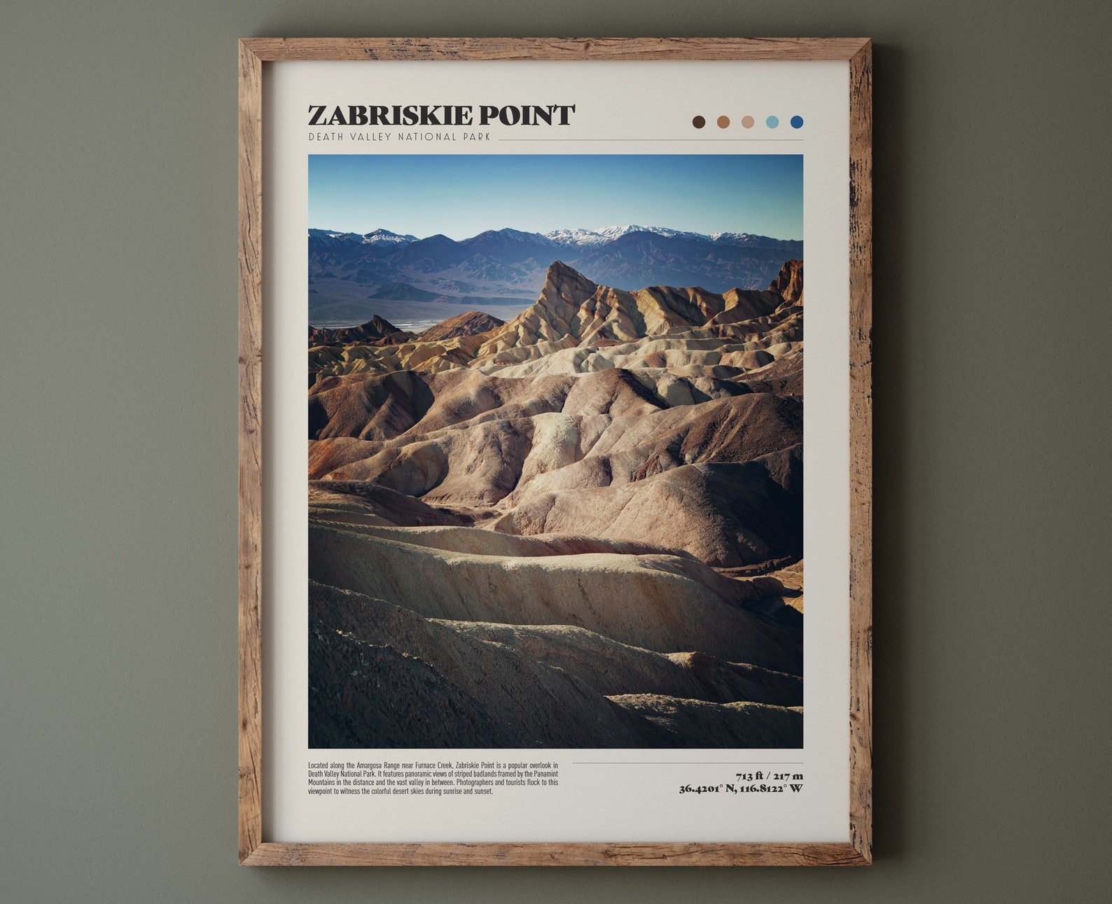
Road damage near Zabriskie Point in Death Valley National Park
Towne Pass to Stovepipe Wells
As you head over the summit at Towne Pass and begin your decent into Death Valley, you’ll encounter several areas where the highway has washed away. In fact, don’t be surprised to come across sections of road throughout the park where the missing asphalt has been replaced by gravel with reduced speed limits enforced. Along this stretch you’ll notice that Wildrose Road/Emigrant Canyon Road is closed, and according to the NPS, it won’t reopen until after February 2024.

Slot canyon along the Mosaic Canyon Trail

Hiking in Mosaic Canyon in Death Valley National Park
Mosaic Canyon
Right before you reach Stovepipe Wells, you’ll find the turnoff for Mosaic Canyon, which takes you along one of the few gravel roads currently open in the park. This 2.3 mile unpaved road is fairly good shape considering the recent storm. They say most sedans are able to handle the drive, although I’m not sure I’d take my Prius on it 😄. I did, however, rent a Kia Sportage for this trip, and it handled the terrain like a champ. Stay tuned in the coming weeks for more information on Mosaic Canyon (full blog and YouTube video coming soon!).

Driving a Kia Sportage on the gravel road to Mosaic Canyon
Stovepipe Wells to Furnace Creek
After enjoying Mosaic Canyon, make sure to top off your gas tank at Stovepipe Wells. If you opt to wait until Furnace Creek, you’ll be paying nearly $3 more per gallon at a whopping $8.20 😱. On the way to Furnace Creek, there are several park highlights that are open, as well as a handful that are still closed to the public. you can enjoy Mesquite Flat Sand Dunes and Devils Cornfield, which are both open currently. However, the turnoffs for Scotty’s Castle & Ubehebe Crater, Beatty Junction, and Salt Creek are all closed to the public. Make sure to stop off and soak in the views along this stretch of the highway though...remnants of the ancient Lake Manly has reappeared, and the valley is dotted with vibrant green shrubs.
Click here for my full blog post on Mesquite Flat Sand Dunes.
Click here for my full blog post on Salt Creek.

Furnace Creek gas prices on 10/15/23

Furnace Creek Campground in Death Valley National Park
Furnace Creek
Arriving at the Furnace Creek area, the first popular stop is Harmony Borax Works. Parts of the interpretive path here has sustained some minor damage, but the short trail is open, as well as the unpaved Mustard Canyon Drive. The nearby Furnace Creek Visitor Center is also open, which is a great spot to learn more about current conditions and ask a park ranger any questions you might have.
If you’re planning a multi-day trip to Death Valley, Furnace Creek is the perfect area to book a hotel night stay. There are overnight options in Stovepipe Wells and Panamint Springs, but I’d highly recommend The Oasis at Death Valley in Furnace Creek, which includes The Inn, The Ranch, and Fiddlers Campground (all open for reservations). The Furnace Creek Campground is also a great option for campers...it features 136 spacious sites with fire pits and access to restrooms with flushable toilets.
Click here for my full blog post on Harmony Borax Works.

Temporary lake at Badwater Basin in Death Valley

Astrophotography at the Badwater Basin lake

Sunrise over the lake and salt formations at Badwater Basin
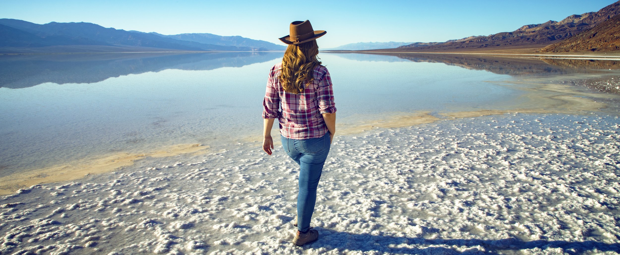
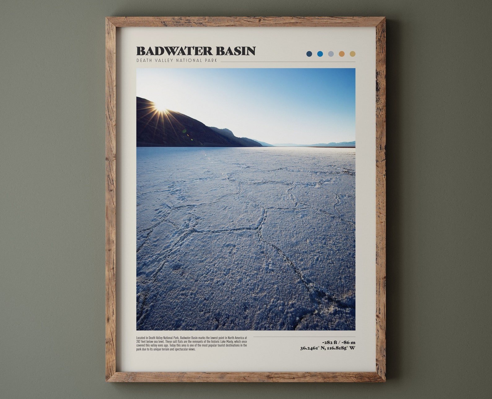
Badwater Basin Temporary Lake
After passing through Furnace Creek, I couldn’t resist heading straight out to Badwater Basin. Vearing off the 190 onto Badwater Road, I set off for lowest place in North America in order to get there in time for sunset. During the approach, the road elevates slightly and provides incredible views of the temporary lake that covers the basin currently. The lake is less than a foot deep, but it covers at least 3 miles wide, providing incredible reflections of the Panamint Range and clear blue skies. Badwater Road is closed just past the parking area for Badwater Basin, and when I arrived I was surprised to see plenty of parking spots still available.
Due to the immense amount of precipitation, the Badwater Basin terrain leading up to the temporary lake has been altered quite a bit. The dirty cracked earth has now been replaced by a thick layer of moist salt that is reminiscent of snow. Your shoes will get quite covered in salt, so keep that in mind when picking out footwear. Another familiar feature you won’t encounter on your trip now are the hexagonal patterns on the ground...they have all been covered and likely removed by the flooding, but I’m sure will return eventually as the water evaporates.
From the parking area, it’s only a short quarter mile trek out to the lake’s edge. You can’t go wrong at any time of day here (unless it’s scorching hot during midday), but sunset and sunrise are ideal times to enjoy this spot. The lighting is perfect for photography, and it’s a joy to see the aspenglow sweep across the surrounding mountains. Keep in mind that Death Valley is an International Dark Sky Park and Badwater Basin is a fantastic place to stargaze...so that’s exactly what I did! Because the lake here is so incredibly rare, I decided to capture sunset, stars, and sunrise here all on the same trip (totally worth it 🤩).
Click here for my full blog post on Badwater Basin.

Badwater Basin lake seen from Natural Bridge parking area
Badwater Basin seen through the canyons along Natural Bridge Trail

Natural Bridge in Death Valley National Park
Natural Bridge Trail
After a wonderful morning at the edge of the Badwater Basin lake, I headed down the road a bit to enjoy a hike to the Natural Bridge. Similar to the Mosaic Canyon road, the unpaved gravel road to the Natural Bridge Trailhead was in relatively good shape, and my Kia Sportage sped up the inclined road without issue...I also witnessed multiple sedans on the road, but taking it quite gingerly. Prior to starting off on the 1.5 mile RT hike, I spent some time enjoying the great views of Badwater Basin from the parking area. The elevation here provides panoramic views of the valley below, making it one of favorite vantage points of Badwater Basin. The hike itself was great, and although there was definitely some signs of debris flow, the trail was intact and the sites were beautiful. Stay tuned in the coming weeks for more information on Natural Bridge (full blog and YouTube video coming soon!).

Artist’s Drive road conditions in Death Valley

Artist’s Palette in Death Valley National Park
Badwater Road & Artist’s Drive
Continuing up Badwater Road towards Furnace Creek, the unpaved gravel roads to Devils Golf Course and Desolation Canyon are open. Although I’m eager to head up towards higher elevation and Dante’s View, I can’t help but take a detour along the incredible 1-lane Artist’s Drive. This 9 mile one-way paved road travels from south to north and weaves you through some otherworldly terrain. The highlight along this loop is certainly Artist’s Palette, which offers a dazzling display of rich colors sweeping across the sedimentary hillside. Although the road is quite dirty from the recent weather, I didn’t notice any major signs of damage.
I’ll also note that nowhere along Badwater Road did I encounter any traffic stops (from Furnace Creek to Badwater Basin)...so hopefully you won’t have to account for any major delays as you head out to any destinations along this road.
Click here for my full blog post on Devils Golf Course.
Click here for my full blog post on Artist’s Drive.

Golden Valley Trail in Death Valley National Park

Rock fall and debris across the Golden Canyon Trail
Golden Canyon Trail
Continuing on Badwater Road, I couldn’t resist a quick stop at Golden Canyon. The parking lot was almost empty, so I parked and hiked up the trail for a bit to see if there were any signs of major erosion from Tropical Storm Hilary. There were certainly some areas where rocks and debris had fallen across the trail, but overall the hiking conditions were great.

Twenty Mule Team Canyon in Death Valley National Park
SR-190 from Furnace Creek to Dante’s View Road
After turning back onto SR-190 at Furnace Creek and heading towards Dante’s View, it’s clear that this area got hit really hard by the recent storm. There are two traffic stops with 1-lane escorts along this drive that have the potential to throw a wrench into your timeline...so if you’re wanting to get up to Dante’s View for sunset, make sure you give yourself plenty of time for traffic delays. The first traffic stop is after Zabriskie Point, which is open and a must stop on any Death Valley visit. However, you can completely bypass this roadwork if you’re up for a bit of an adventure by taking Twenty Mule Team Road through Twenty Mule Team Canyon. This unpaved dirt road is a one way narrow drive that is only suitable for high clearance vehicles like my Kia Sportage, and it’s been compared to a rollercoaster experience...I’d definitely affirm that, it starts out pretty tame but then weaves up and down through the canyon!
The next traffic stop shows up a couple miles later and continues all the way to the turnoff for Dante’s View Road...it’s a bit of a doozy. During my trip, one direction all cars were being let though but upon my return the road workers at this spot were only allowing 8 cars to follow the escort vehicle at a time, causing quite a backup. This was especially challenging coming back since there was a decent amount of traffic traveling into the park from the east entrance here via Death Valley Junction.
Click here for my full blog post on Zabriskie Point.

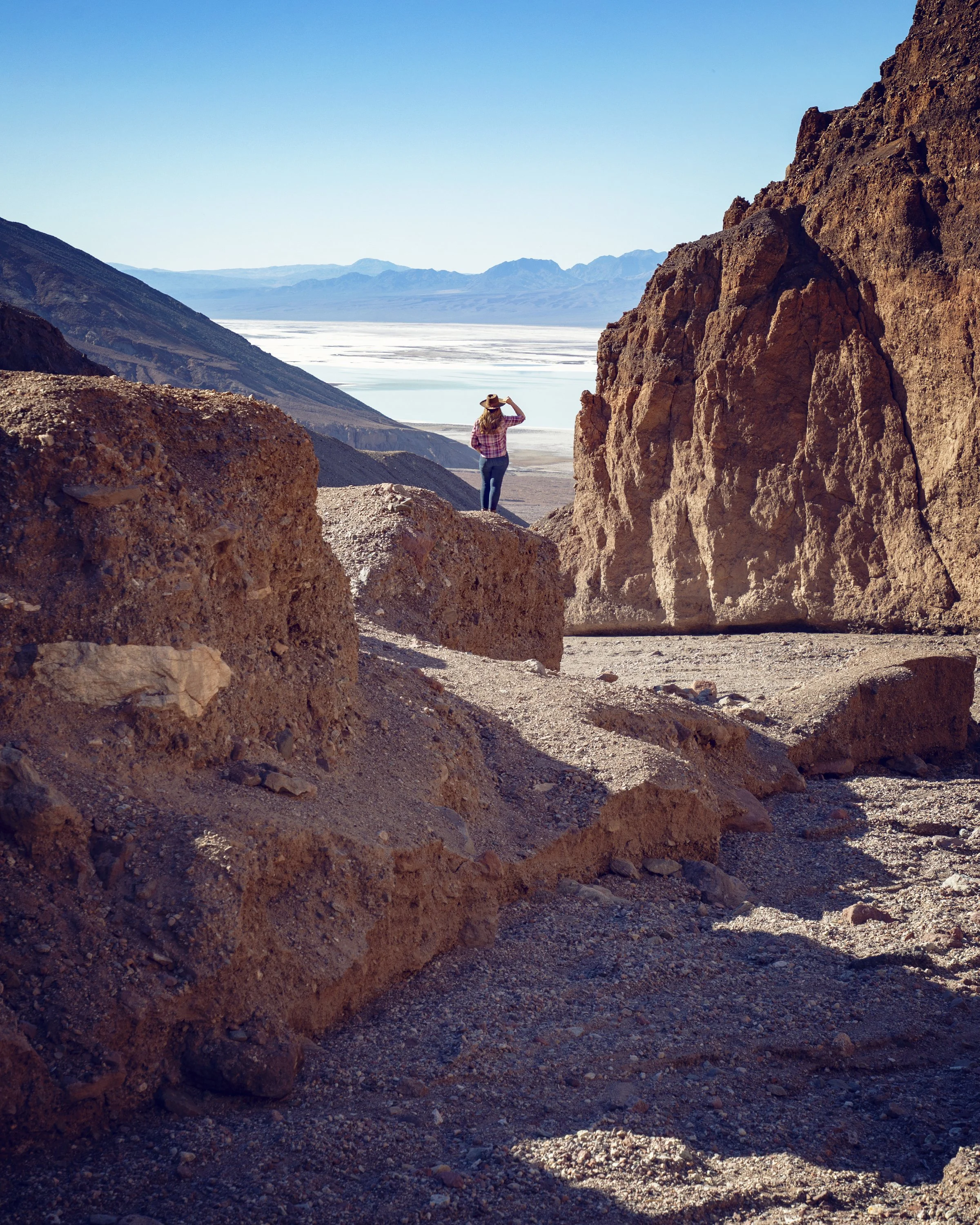
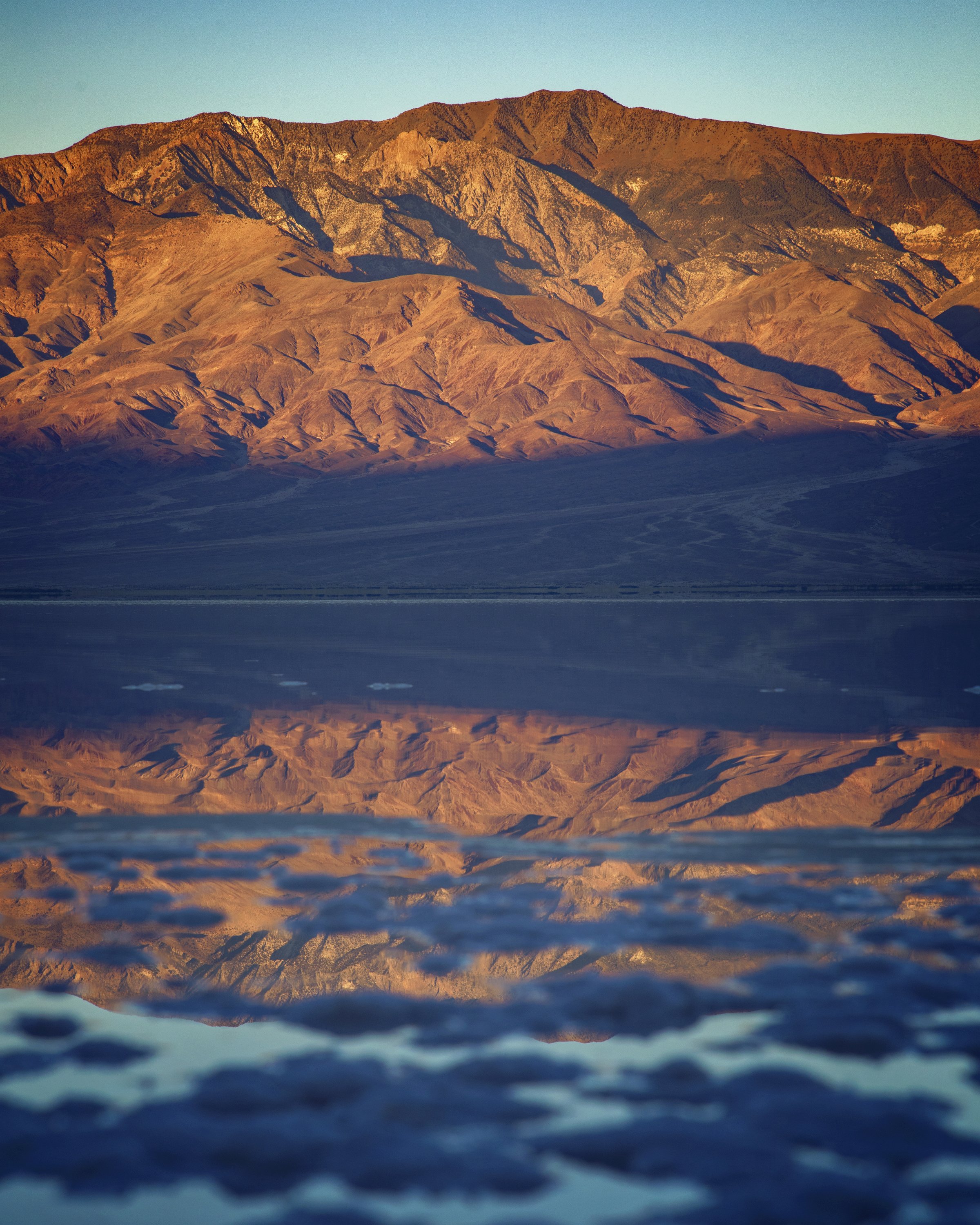
Badwater Basin lake seen from Dante’s View
Dante’s View
Once I got through the traffic stops along SR-190, Dante’s View Road was pretty much smooth sailing. There were a few little areas where the road had eroded away, but crews had already filled them in. If you haven’t visited Dante’s View yet, now would definitely be the time to do so. You can enjoy the panoramic views right from the parking area, or head out on a hike on trails to the south and north of the main viewing platform. The magnitude of the temporary lake covering Badwater Basin is very apparent from Dante’s View. It’s quite a sight to see the eerie green water stretch out for miles. Check out the comparison picture below of what the the view looked like before and after Tropical Storm Hilary tore through the valley.
Click here for my full blog post on Dante’s View.

Before and after of the Badwater Basin flooding seen from Dante’s View

Milky Way astrophotography over the Badwater Basin lake
Know Before You Go
• Hiking in Death Valley is not recommended after 10am in the brutal heat of Summer months. Always bring extra water and sun protection for any Death Valley adventure.
• If you’re hoping to see the temporary lake at Badwater Basin, I’d recommend you visit as soon as possible. Park officials predict it could dry up within the next few weeks. See my “Death Valley Current Conditions” video below from last week to see what Badwater Basin looked like on opening day.
• Please remember the Leave No Trace Principles so this park’s natural beauty can be enjoyed for years to come.
• If you’re heading out for sunset away from your vehicle (particularly at Badwater Basin), make sure to bring a high-powered flashlight for hiking back in the dark.
• Anytime you visit Death Valley, I highly recommend bringing a GPS device or smartphone equipped with a GPS app and pre-loaded maps (I recommend and use Gaia). Cell service is minimal throughout the park, and it is very easy to get turned around in this vast desert when trails are not clearly clearly marked.
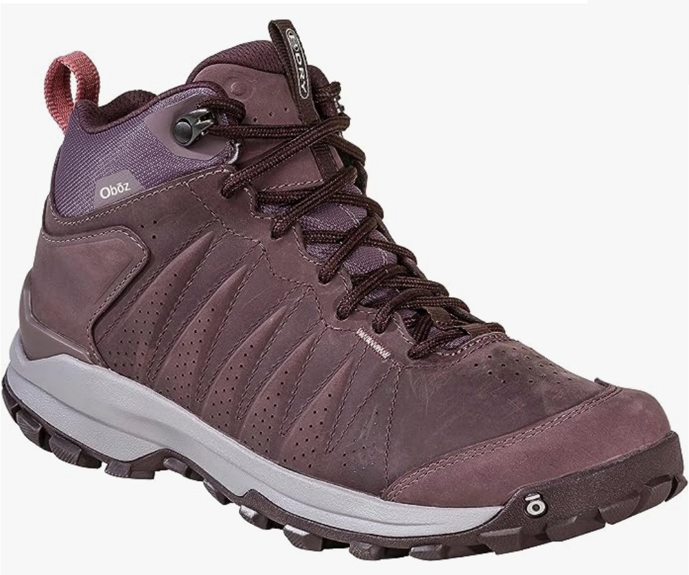
• Make sure to wear quality footwear when hiking in Death Valley, as terrain is often uneven and unstable...here is a post with my top hiking boots & shoes.
• Always check the official Death Valley NPS website for current weather and road conditions prior to visiting.
• The main cause of death in Death Valley is not actually heat related incidents but rather single-car accidents. To avoid an accident, always follow the speed limits, shift to a lower gear on steep downhill grades and obey all traffic signs.
Top 10 Things to Do in Death Valley Currently
Golden Canyon
Natural Bridge
Mosaic Canyon

Badwater Basin flooding in Death Valley
In Summary
Thanks so much for joining me this week in Death Valley National Park. For a virtual visit of what the park looked like the first week it was back open, make sure to watch my Behind the Blog video at the top of this post, or watch it on YouTube here. Until next week, I hope you find adventure and encouragement where you go!
Telescope Peak reflected in the Badwater Basin lake at sunrise
Shop the Post

Death Valley Products from Our Etsy Shop


If you enjoyed this post, you might also like…


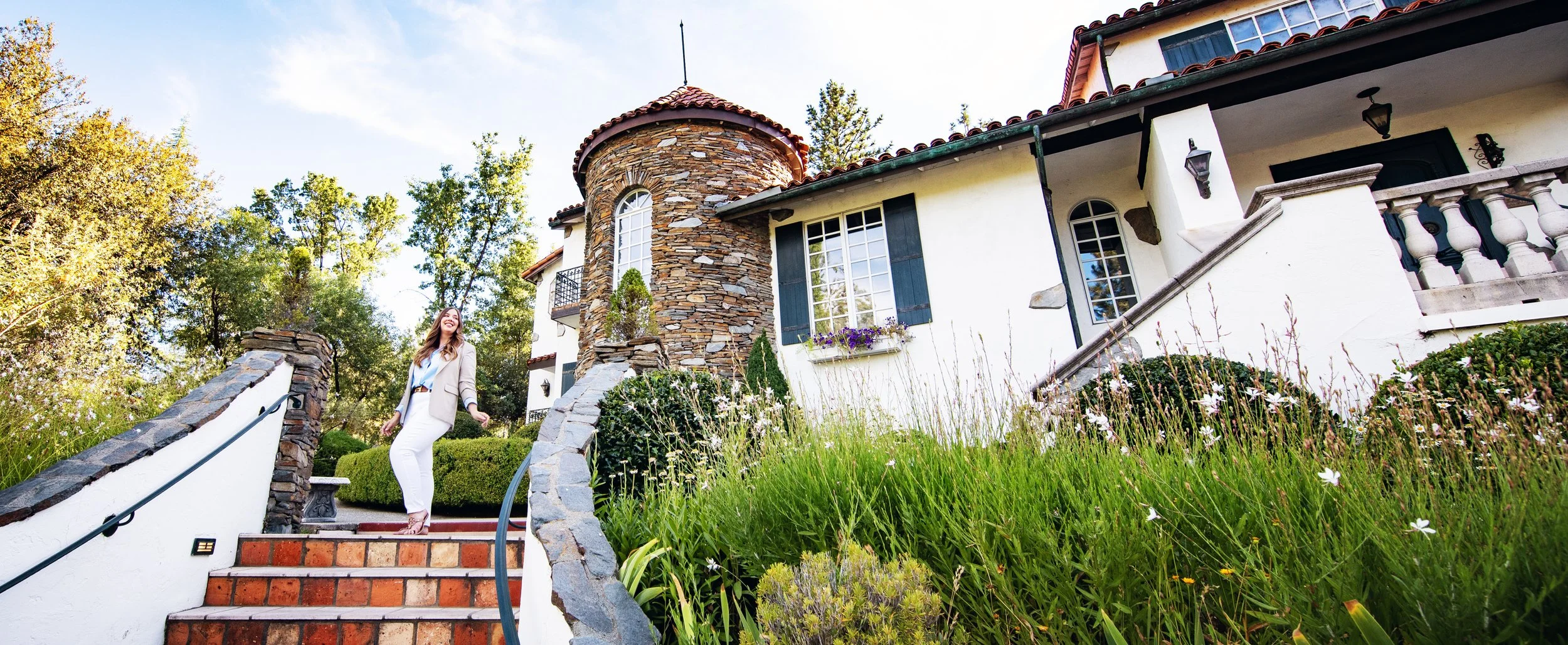
About Me
I’m Dawn Marie, a travel and lifestyle blogger based out of Southern California. With in-depth articles, travel guides, and reviews on hotels & products, I seek to share my journeys to help you plan for your own. My adventures take me all over California, the western United States, and around the globe...and every Monday I post new content here, including a comprehensive blog post and YouTube video.
Search the Blog
Featured Posts


Etsy Shop

Discover the best astrophotography locations in California and learn how to capture stunning night sky photos. From Yosemite to Death Valley and Joshua Tree to Sequoia National Park, this beginner’s guide covers top gear, camera settings, top dark sky spots, and tips for photographing the Milky Way, stars, and constellations. Experience the awe of God’s masterpiece under the stars with me!