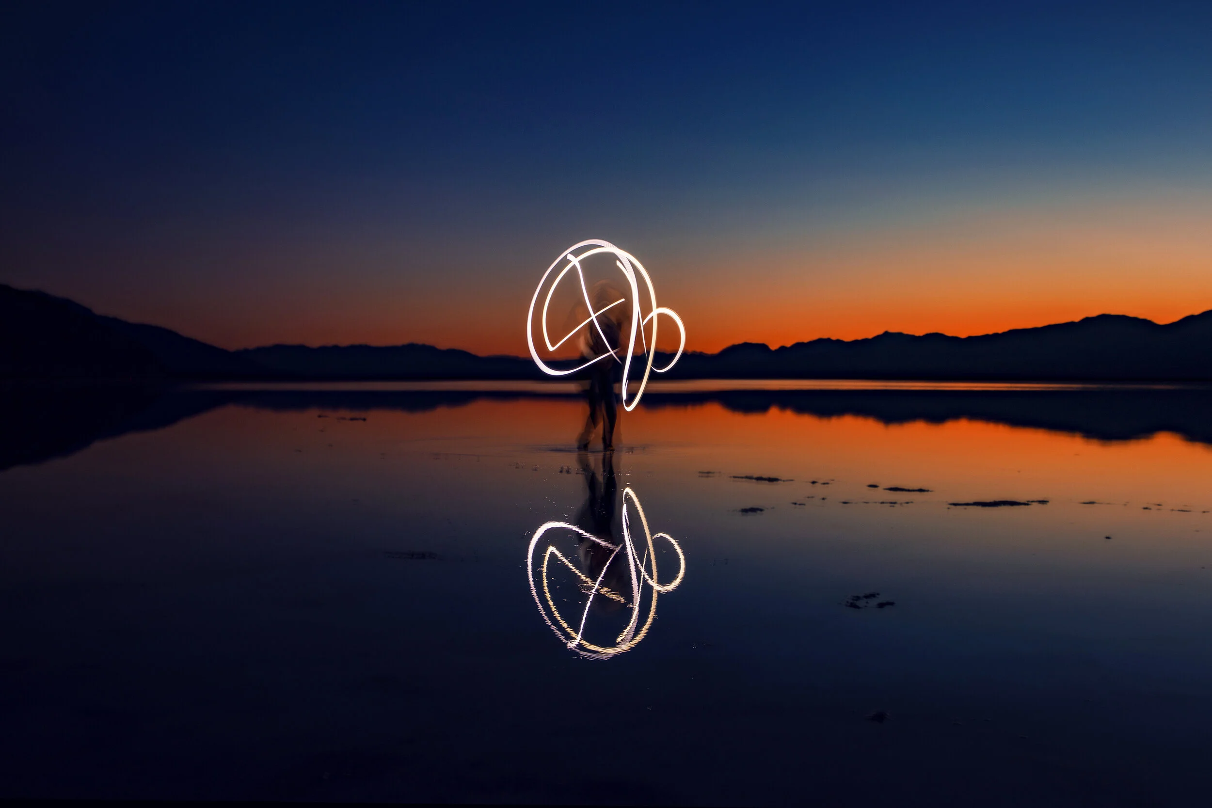
Badwater Basin - Sunset After a Storm

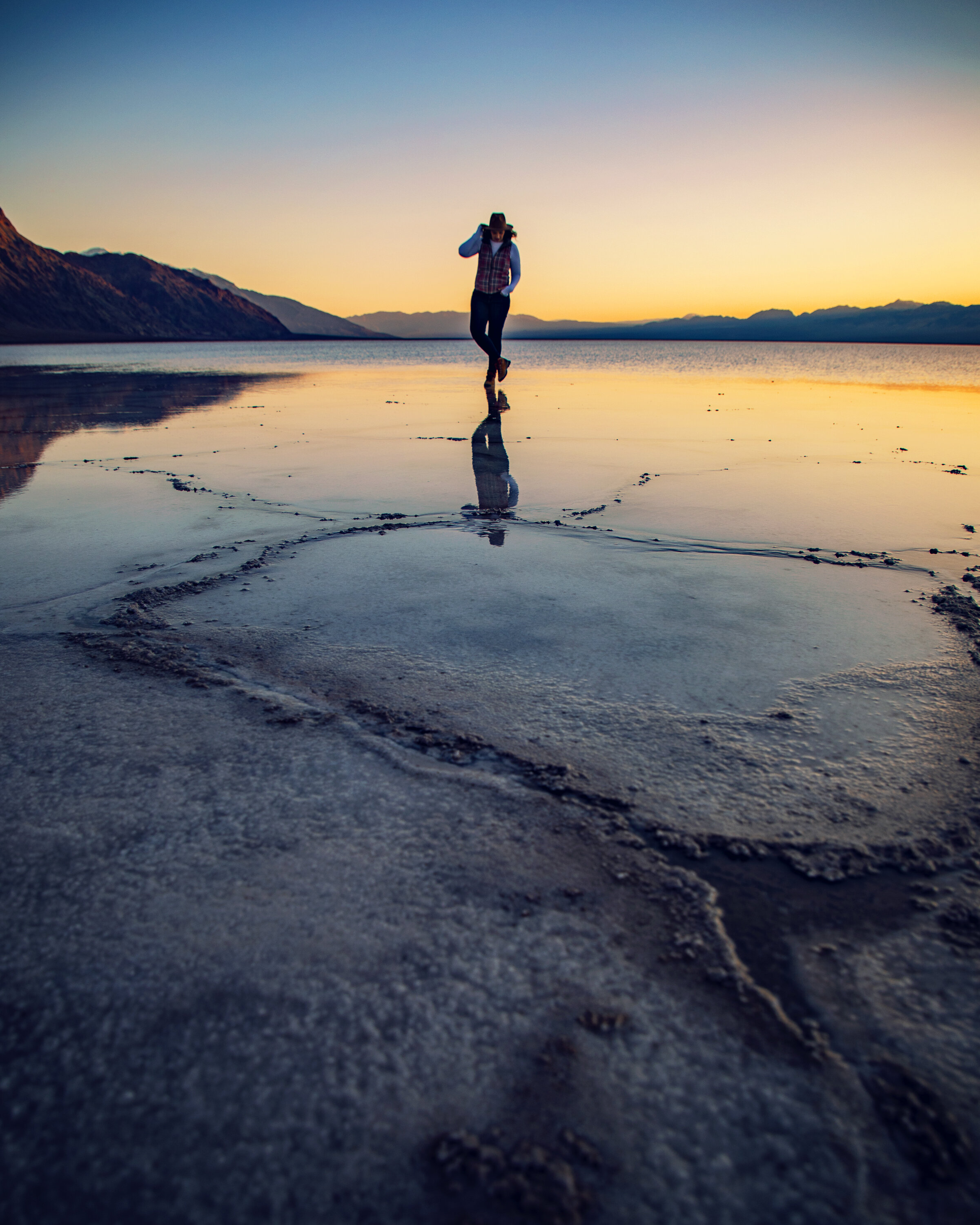
If you’re familiar with Death Valley, then you may already be aware one of the popular sunset spots in the park is Badwater Basin. As the sun moves low, long shadows cast over the salt flats, making you feel as if you’re exploring another planet…it’s a photographers dream! On the rare occurrence of heavy rains and flooding, the basin can transform into a glassy lake unlike anything you’ll find in Death Valley.

Geography
Badwater Basin is the lowest point in North America, sitting 282 feet below sea level. It received its name from the extremely saline, undrinkable water found here. As rain falls on distant peaks and floods down, it comes to rest here at the lowest point. This endorheic basin has a small natural spring with no outlet. So as the water evaporates, the minerals concentrate, leaving only salt crystals behind. With an evaporation rate of 150 inches a year, even a 30 mile long 12 foot deep lake would be completely dried up in a single year. These salt flats cover nearly 200 miles, making them some of the largest protected salt flats on earth.


Temporary Lake
When the Amargosa River floods, a large temporary lake can develop here, casting stunning reflections of the Panamint Mountains in the distance…but the water is always short-lived. If you want to enjoy this spectacular phenomena, plan a visit no more than a day or two after a storm with heavy rains. Watching the sun set over the glassy water is magnificent. The cherry on top of the sundae is being treated to more stars than you could ever hope to count and a front row seat to see the Milky Way once twilight has faded away. There’s nothing better than dancing among the stars in the pitch black of a new moon night here.

The Location
I love looking up from Badwater Basin to Telescope Peak, the tallest point in the park, sitting 11,000 ft above sea level. Dante’s View also rises intimidatingly high behind the basin…and if you look up into the mountainside carefully, you’ll find a sign showing just how far below sea level you are. While Death Valley is known for its extreme heat (it holds the record for the highest temperature in the world at 134 degrees), it can also get bitingly cold in the winter. You might even see snow covering the mountain peaks in December or January.


Badwater Basin is located 30 minutes south of the Furnace Creek Visitor Center. The large parking lot here fills up quickly because this spot is so popular. Always check the weather, because extreme wind or summer heat can make it uncomfortable to get out of your car and explore. The real treat here is walking past the wooden boardwalk to enjoy the endless salt polygons (I’d plan to walk at least a 1/4 of a mile on the salt flats). If you’re unfamiliar with the terrain and recent weather occurrences, be cautious when exploring, because in some cases the delicate sand crystals can easily be crushed breaking through to layers of thick mud below.


Important facts to keep in mind when visiting:
• Fall, Winter and Spring are the most mild (best) seasons to visit.
• Always bring extra water and sun protection any time of year.
• Pets are not allowed.
• Restrooms are located near the parking area.
• If visiting after dark, always bring extra lights such as a high-power flashlight or headlamp.
• There is no cell service here, so don’t rely on your phone for information, including maps/directions.
Photography Tip: If you’re visit revolves heavily around photography, I highly recommend going for sunrise or sunset. The low sun on the cracked earth creates a beautiful texture. When the sun is high at midday, those details aren’t captured as well.


In Summary
Death Valley is full of extremes, both harsh and gentle. Few places show this off as well as Badwater Basin after the rains. For more information check out my Behind the Blog video at the top of this post…and whether you’re heading into a desert or a beautiful oasis, I hope you find adventure and encouragement wherever you go.
If you enjoyed this post, you might also like…


About Me
I’m Dawn Marie, a travel and lifestyle blogger based out of Southern California. With in-depth articles, travel guides, and reviews on hotels & products, I seek to share my journeys to help you plan for your own. My adventures take me all over California, the western United States, and around the globe...and every Monday I post new content here, including a comprehensive blog post and YouTube video.
Search the Blog
Featured Posts


Etsy Shop
Discover the best astrophotography locations in California and learn how to capture stunning night sky photos. From Yosemite to Death Valley and Joshua Tree to Sequoia National Park, this beginner’s guide covers top gear, camera settings, top dark sky spots, and tips for photographing the Milky Way, stars, and constellations. Experience the awe of God’s masterpiece under the stars with me!